 vesseltracker.com
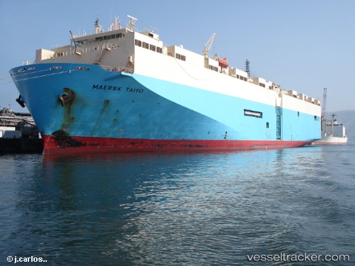
Vessel 477625700 IMO: 9088237, MMSI: 477625700
UTC, 13.51167, 49.98833, course: -1, speed: 16
UTC, 13.42833, 49.73167, course: -1, speed: 15
2026-02-01 15:54:37 UTC, 13.21667, 49.05500, course: -1, speed: 15
Live AIS position:
UTC. 68 nm SE of Balhaf),
updated 2026-02-01 15:54:37 UTC.
Find the position of the vessel 477625700 on the map. The latter are known coordinates and path.
marine traffic ship tracker show on live map
The current position of vessel 477625700 is 13.21667 lat / 49.05500 lng. Updated: 2026-02-01 15:54:37 UTCDetails:
Last coordinates of the vessel:
UTC, 13.65833, 50.46667, course: -1, speed: 15UTC, 13.51167, 49.98833, course: -1, speed: 16
UTC, 13.42833, 49.73167, course: -1, speed: 15
2026-02-01 15:54:37 UTC, 13.21667, 49.05500, course: -1, speed: 15